

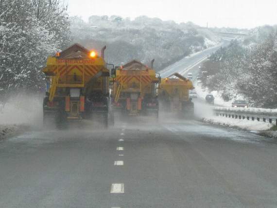
A COLD and windy ‘Polar’ weather front will be felt in South Devon tomorrow, bringing heavy rain, strong winds, and possibly some snow.
The Met Office has issued a yellow - ‘be aware’ - warning for wintry weather throughout Thursday day and night, and into Friday.
A spokesman for the Met Office said: ‘A Polar maritime air mass, with its origins over northern Canada, will spread southwards across the UK in the next 24 hours, bringing a real taste of winter to the whole of the UK from Thursday.
‘Although the south of the country is likely to avoid the majority of the snow showers, this area will have a wet day on Thursday with persistent heavy rain for much of the day, which is expected to turn to sleet or snow for a time in the afternoon and evening.’



Paul Gundersen, chief meteorologist, added: ‘Southern counties of England and Wales can expect a cold and wet day with some heavy rain on Thursday, but there’s an increasing chance this will turn to sleet or snow, especially over hills, during the afternoon and evening.
‘There’s a chance of snow settling and bringing disruption to transport during the evening rush hour. And as skies clear on Thursday night it’s likely to become icy in many areas.
‘Forecasting snow is always challenging and there’s often a fine line between whether it will rain or snow in a particular location depending on slight changes in air temperature.’
Daytime temperatures in South Devon are likely to be around two to five degrees Celsius, but the strong to gale force winds will make it feel much colder. Overnight temperatures are expected to dip below freezing.
The cold weather is expected to continue into the weekend.
Public Health England has warned residents to wrap up warm - in several thin layers of clothing - and keep houses heated to 18 degrees Celsius or more.